First Stop...
Menotomy Rocks Park!
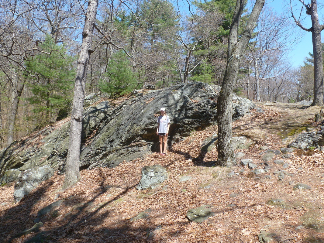
This large exposed rock is bedrock at Menotomy Rocks Park!
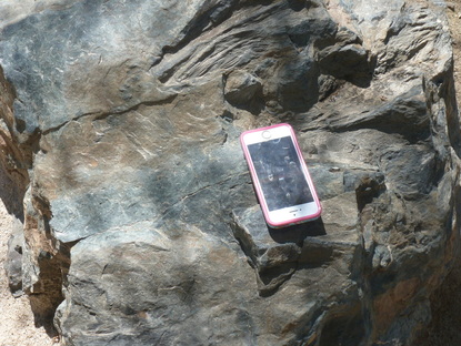
In the picture above is an erratic found at Menotomy Rock Parks!
|
As you enter this beautiful rock park in Arlington, MA you first notice the large dark colored boulders. These large exposed rocks were created millions of years before the last glaciations. This is bedrock. The bedrock is Cambridge Argillite, which is a sedimentary rock. The material formed when the Avalon Terrane began rifting apart 570 million years ago. This allowed sediment to fill the newly created rift valley. Due to low heat and pressure during this period, the sedimentary rocks were slightly metamorphosed. This rock overlies Roxbury Conglomerate. Cambridge Argillite and the Roxbury Conglomerate formed between 570 to 595 million years ago. The Roxbury Conglomerate overlies Dedham Granite, which formed 610 millions years ago and Westwood Granite, which formed 599 million years ago. Mattapan Volcanic Complex also lies beneath it, this formed 596 millions years ago through the volcanic activity during the Avalon Terrane formation. These all formed during the Precambrian period, more specifically in the Neoproterozoic Time (National Parks Service).
The picture on the left shows a boulder left behind from the Wisconsin Period. This small boulder is called an erratic and was carried on top of the the Laurentide Ice Sheet until it fell off the snout as the glacier melted. It was then left to rest here in Menotomy Rocks Park 15,000 years ago during the ice sheets retreat. These large boulder could possibly have traveled for hundreds of miles on top the glacier as part of its load, therefore it is hard to get the exact age. It is evident that this rock was carried on top of the glacier because the rock is angular and was not carried on the bottom of the glacier where it would have been smoothed and ground up. Many erratics are in this area, all with compositions that differ from the Cambridge Argillite bedrock. Watch the video below for more about erratics!
|
Let's head a little bit down the road to our next stop....
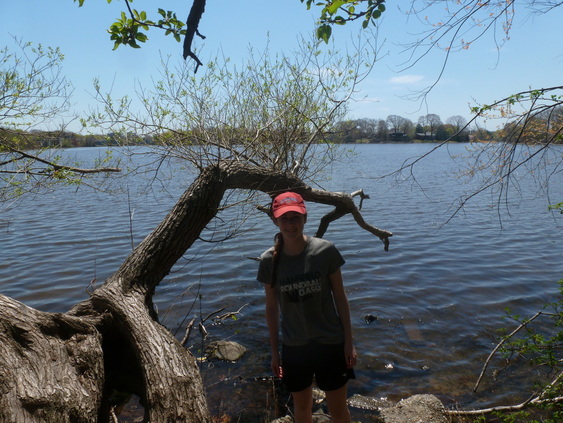
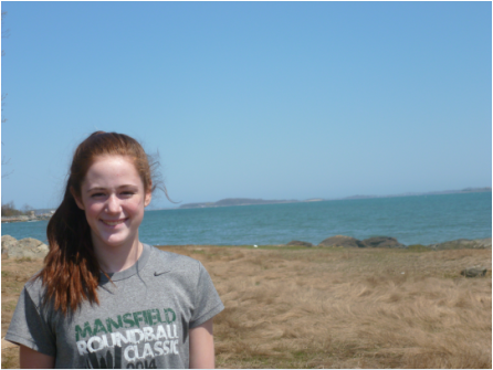
Spy pond (pictured above) is a kettle pond originally formed by glaciers.
Next feature...Spy Pond!
Welcome to beautiful Spy Pond! Spy pond is a kettle lake located in Arlington, MA. Spy Pond consists of 103 acres of kettle lake (Spy Pond Academic). Around 50,000 years ago, Arlington was covered in ice about one mile deep (Spy Pond Academic). Spy Pond formed about 15,000 years ago when the Laurentide Ice Sheet retreated. It formed when a block of ice broke off from the glacier and was buried by sediment, or till. After some time, the ice melted leaving behind kettle holes or depressions. Later on, these Kettle holes were filled with melt water from the Laurentide ice sheet and created Spy Pond (Spy Pond History). At first the pond was only filled up with the water from the ice sheet, but now it is filled by groundwater and runoff from the land. Kettle lakes are generally circular because melting blocks of ice are normally rounded. Kettle lakes can be found in groupings or by themselves (Geo Times). Spy pond averages at twelve feet deep, but it can reach up to 36 feet deep (Spy Pond History)! Many other kettle lakes were created in the area in the same way as Spy Pond. These include ponds such as Fresh Pond in Cambridge, Mystic Lakes in Winchester, Horn Pond in Woburn, Walden Pond in Concord, and Crystal Lake in Newton.
Fun Facts:
Spy Pond has an island in the middle called Elizabeth Island!
Spy Pond was used to harvest ice from in the Winter during the nineteenth century!
Fun Facts:
Spy Pond has an island in the middle called Elizabeth Island!
Spy Pond was used to harvest ice from in the Winter during the nineteenth century!
Watch the video below to learn more about kettle lakes!
After leaving the pond, we drive all the way to Harvard Square to see our next feature!
The steep slope on Harvard University's Smithsonian Astronomical Lab may seem just like an ordinary slope. However, this slope is an end moraine created by a glacier.
|
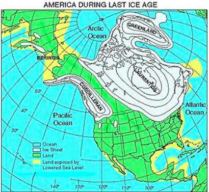
This is the ice sheet at its maximum extent, notice how it ends near the edge of Massachusetts (The Retreat).
|
Harvard University's End Moraine
This feature is an end moraine. An end moraine marks the position in which a glacier was stationary. There is an end moraine at Harvard, the steep ridge pictured above. This formed about 21,000 years ago when the Laurentide Ice Sheet was at its maximum extent (Illinois State). It formed when material was bulldozed from the glacier and eventually fell off the snout of the glacier when the glacier was done with its advance (National Geographic). This created a ridge perpendicular to the flow of the glacier called an end moraine. This shows the flow was from Northwest to Southeast. The end moraine is poorly sorted, consisting of sand and rocks. This indicates the last point the glacier stood, before it retreated about 15,000 years ago . The Laurentide Ice Sheet originated in on the mountains of the Arctic Islands of Canada that were centered over Hudson Bay and Labrador-Ungava plateau. At its maximum extent the ice sheet covered at least 13,000,000 square km and reached as far south as latitude 37° N (Laurentide Ice Sheet). Watch the video below to learn more about end moraine!
Let's head over to the harbor to see more features!
Boston Harbor Drumlins!
The asymmetrical hill pictured above is called a drumlin. On the left, the drumlin has a steep slope. On the right, there is a long flat slope pointing to the direction in which the glacier was moving. This glacier was moving northwest to southeast, as shown by the gentle side pointing Southeast.
|
This an aerial view of the drumlins, notice the gentle sloping sides pointing to the southeast if North is the top of the map (Boston Geology).
|
Boston Bay Drumlins
The drumlins in Boston Bay were created roughly 16,000 thousand years ago by the Laurentide Ice Sheet. Drumlins are depositional features and form when the glacier retreats. As the glacier passed over the old hill, it first bulldozed one side of the glacier and then glided over the other side with its melt water (Kaye). This material was deposited by the glacier to create these features. As a result it created a steep side of the hill and a long flat slope. They are low to the ground and elongated features. The drumlins are made up of till of all sizes (boulders, pebbles, and sand) deposited by the glacier during its retreat. Drumlins are often found in groups or "swarms" as islands. There are about 200 drumlins in the Boston Basin, 30 of which are in a swarm (National Park Service). They can reach from 30 to 60 meters above the basin (Martin). Since the sea level has risenfrom the past, these drumlins now appear to be rounded, stranded islands (Martin). These islands formed over two periods of glaciation and have several drumlins on them. These islands are still being changed today by erosion from natural processes (National Park Service). Watch the video below to learn more about Drumlins!
Fun Facts:
The drumlins at the Boston Basin are very rare! They are the only swarm of drumlins that intersect a coastline in the U.S (National Park Service).
Although Drumlins and Roche Mountennee's appear to be very similar, Drumlins are depositional features and Roche Mountennee's are erosional features! Unlike drumlins, a Roche Mountennee's steep side points to the direction in which the glacier was moving to.
To view more images click on the button below
